Day 2: Ennerdale Bridge to Black Sail

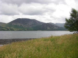
Ennerdale Water

Ennerdale Water

Something I learned about English weather – you never know what’s gonna happen.  In the picture above you see lots of grey clouds – which on the East Coast of the States usually means that some storms are on the way.  However, these types of clouds would typically blow over, and we’d get rained on when we least expected it.

views of Green Gable and Great Gable from Black Sail Youth Hostel

Views of some pine tree plantations. In the 1930s someone thought it would be a great idea to plant pine trees in Northern England - even though they aren't/weren't native.

View from our room at Black Sail Youth Hostel

View from our room at Black Sail Youth Hostel

Day 1: St Bees to Ennerdale Bridge

view from our room at Stone House Farm - 9:30PM (I was amazed at that hours of daylight - loved it!)

view from our room at Stone House Farm - 9:30PM (I was amazed at that hours of daylight - loved it!)

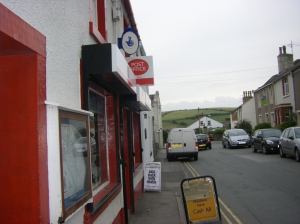
Post Office in St Bees.  The Post Office was not only the place to mail stuff - it was like a general store, too.

Post Office in St Bees. The Post Office was not only the place to mail stuff - it was like a general store, too.

St Bees train station

St Bees train station

statue of St. Bega for whom St. Bees was named.  She was an Irish princess who fled her native country sometime between the 6th and 9th centrues to avoid an arranged marriage with a Norwegian prince.  She lived as a hermit, but was known for the good deeds she performed - including opening an convent.

statue of St. Bega for whom St. Bees was named. She was an Irish princess who fled her native country sometime between the 6th and 9th centrues to avoid an arranged marriage with a Norwegian prince. She lived as a hermit, but was known for the good deeds she performed - including opening an convent.

A tribute to some incredible people

As we planned our trip, and created our donation page, we encouraged people to email us with the names of family or friends who’s lives were lost to cancer – or to those survivors who are kicking cancer’s butt.  It was my intention to dedicate each day of this walk by making a post “This day’s walk is dedicated to…”  Unfortunately, we dealt with unreliable internet access, so I decided to create a special post to recognize these folks.   We are grateful to the following incredible people that reminded us to put one foot in front of the other and continue the challenging journey:

Lila

Sam

Shelly

Sharlene

Cathy

Merle

Theresa

Dale

Judy

Linda

Bonnie

Ralph

LaVerne

Fred

Irene

Linda

Eddie

Josiah

Sharon

Brenda

Lisa

Pam

Trish

I cab honestly say that these folks helped get us over some major fells (hills).

Just for Fun: Vocabulary lesson for Carla

As you might expect, I kept a journal during our C2C journey.  Part of my journal included my new vocab words.  Caroline was a great interpreter, and taught me many new words.  Here are some examples:

Cheers (also Ta) = Thank You

Pudding = steamed cake (if anyone offers you Sticky-Toffee Pudding – take it!  However, I also had a Suet Pudding which was steamed beef and potato entree served in a crust of suet.  I tried lots of interesting foods in England.)

boot = trunk of the car

serviette = napkin

jacket potato  = baked potato

Sarni / Buttie = sandwich

Plasters = band-aids

Chips = French fries

Crisps = Potato chips

Fell = Hill

Beck = Stream

Tarn = Lake

Sweeties = candies

Boiled sweets = hard candy

Cream tea = A cup of tea which is served alongside scones with jam and clotted cream (again, if you are offered a cream tea – take it!)

Off-license = a place to pick up alcohol that is not a pub

Slimline = diet tonic (This was an important one for me.  I drink gin and tonics, so I’d order a ‘gin and slimline’.  Another change, the English use lemon instead of lime, and typically don’t have a bunch of ice in their drinks).

flannel = washcloth

sultanas = raisins

porridge = oatmeal

courgettes = zucchini

aubergine = eggplant

mash = mashed potatoes

bicky = Cookie

Biscuit = Cracker

Much stronger now – our walk is complete!

We did it!

Our time on the trail in England went by so quickly.  I’m pleased to report that with sore feet and big smiles we walked into Robin Hood’s Bay

Robin Hood's Bay - before high tide

Robin Hood's Bay - before high tide

and finished the Coast-to-Coast walk at 3pm (GMT) on Saturday, July 25.

woo hoo!

woo hoo!

As is tradition, we walked into Wainwright’s Bar at the Bay Hotel and ordered a drink to toast our achievement.  We signed a C2C registry to mark our trip completion and even got Completion Certificates.

Great job, Caroline!

Great job, Caroline!

who's excited to read the THE END sign?!   ME!

who's excited to read the THE END sign?! ME!

Day Off in Richmond

We took a well deserved day off in Richmond today – which was GREAT despite the rain.  In fact, we were glad the rain day was today, and not tomorrow when we have some miles to put away. 

So, we took care of some function stuff like banking and laundry.  Not many banks or washing machines on route, I might add.  Then it was off to explore the streets of Richmond.

The Market Square in Richmond

The Market Square in Richmond

The town is our largest enroute with a large-ish market square, lots of pubs, shops and, of course, banks etc.  But the biggest attraction was that it has a castle, museum and some interesting places to poke around.

Richmond Castle

Richmond Castle

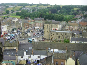
View of town from Castle walls

View of town from Castle walls

Our B&B - Willance House - where we are staying for two whole nights!

Our B&B - Willance House - where we are staying for two whole nights!

After exploring the museum and castle in the rain (great views!) we headed over to the old railway station that has been converted into a movie theater and watched Harry Potter.  Perfect!  It was great to do something completely different.

Tomorrow we are crossing the Vale of Mowbray which is a flat stretch of farmland between the Yorkshire Dales and the Yorkshire Moors.  At 23 miles its going to be a long one… praying for fine weather!  Rumour is that the pub in Ingleby Cross has an internet connection, so will post again from there if we can.

At Richmond

Finally back on a good computer at Richmond library.  We have a few days catch up to do as we have been off the grid for a bit.

So here goes:

Friday – Patterdale to Shap

Least said about this day the better, but here are a few keywords to give you an idea about the experience:

11 hour hike

17.5 miles

3000 feet climb

Non -stop rain and hail

White out conditions – navigation by compass only..

As you might guess – no photos for this day!!

7pm arrival at B&B at 1% spirit level….

Saturday – Recovery day.  Change of plan as Friday was so horrendous.  We took the bus to Kendal and then went on to Kirkby Stephen from there. 


IMGP1046

St. Hedda Church in Kirkby Stephen (dating back to 1600s)
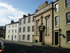
Temperance Hall - Kirkby Stephen

Temperance Hall - Kirkby Stephen

It took a whole day to get our spirits back up to recharge.  We were just thankful to be safe, blister-free and dry!!

IMGP1063

Franks Bridge in Kirkby Stephen - an example of the incredible stonework everywhere in England

Sunday:  Dead Bunny Day!  Took hike from Kirby Stephen to Low Row, via Keld.  Hiked via road through Moors, crossing line over  from Cumbria into Yorkshire, entering the Yorkshire Dales National Park. 

We waved goodbye to Cumbria

We waved goodbye to Cumbria

...and said hello to Yorkshire Dales National Park

...and said hello to Yorkshire Dales National Park


Keld was the official half way mark and felt like it!.  At about 2pm we recharged on sandwiches at the Keld Lodge and then tackled another 6 miles down the River Swale to Low Row. 

waterfall in Keld at disused mine
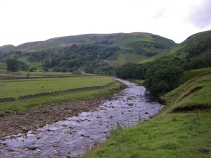
waterfall in Keld at disused mine

A view of the River Swale - beautiful backdrop for our hike to Low Row

A view of the River Swale - beautiful backdrop for our hike to Low Row

Total of 18 miles for the day.  Weather not bad.  Leg muscles good..but shattered!  (PS.  Lots of dead bunnies squigged in road.  Also bunny bits, dead hedgehogs, dead birds, dead mice … you get the picture!  This is one of the disadvantages of road walking.

Monday – Hiked from Low Row to Richmond – 17 miles, 7.5 hours, weather pretty good.  Took road down to Reeth.  In Reeth, some may recognize locations used in ~All Creatures Great and Small~.  Beautiful village green, little teas rooms, stone cottages and a museum. 

view of the Reeth Village Green

view of the Reeth Village Green

We stopped at the post office/general store to restock before taking the balance of the hike (10 miles on to Richmond).  Loads and loads of stiles through hay fields and meadows. 

caroline standing beside a cairn from Applegarth Scar - overlooking Marske

caroline standing beside a cairn from Applegarth Scar - overlooking Marske

Lots of cows and sheep (different breeds)

3 of the thousands of our new friends - sheeep!

3 of the thousands of our new friends - sheeep!

…more stiles… gaps in stone walls with little fence doors….very sore calves (that’s the calves on our legs – not the baby cows)!!
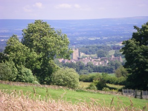
First glimpse of Richmond Castle from the trail

First glimpse of Richmond Castle from the trail

yah!  We finally reached Richmond!

yah! We finally reached Richmond!


We are taking the day off tomorrow to relax and enjoy Richmond’s charms..  There’s a castle, museum and possible somewhere to catch the new Harry Potter movie?  Need to work on that one!  Will try and post again tomorrow.

At Patterdale

ok- to start we are at a pub internet terminal and thekeyboard reall y stinks.So we are nnont going bak to corect errors…

Too muh to tell on this keyboard but trek to Stonethwaite from Black Sailwentwell.  We got to he ridgeof Loft Beckbut couldn’t findthe path.  We could see where we wantedto go but could findhow to get there.  So we blazed a path. Arrived safe in Honister. Waseasy from thereon.

Wokeup on Weds and weater was bad.  Went anoter way to Grasmere along Derwentwater lake to Keswick.  Took Carla on double deckerbus dow to Grasmere.  No other way.

Toured Grasmere.  Saw RAF planes and Wordsworth grave.  (I hate this keyboard)…

Next mornng left for 10 mile hiketo Patterdale.  It was a eally beautiful hike.  Took lots of pictures but stupid pub computer has no usb port!!!!    Rained alot but arrived safe.

Tomorrow forecast is heayvy rain andwe haveworstday of hiking of trip. (16 miles, huge climb, sharp fall, long long overland hike) Oh well.. it sounded like a good idea atthe time!!!

Signing offb before I kickthis thing!!

At Stonethwaite (near Rosthwaite)

We arrived safe and sound into Stonethwaite village this afternoon, after hiking from Black Sail last night.  I will fill you in on yesterday’s leg from Ennerdale to Black Sail before dinner and then we might tackle today’s adventures later if time permits.

So we set off from Ennerdale late in the day, around 11am as the hike to Black Sail was only about 8 miles.  Usually Carla and I were training at about 3-4 miles/hour.  However, the terrain here is so much rougher, and with all the stops, starts, map checks (loads) and occasional misjudgments, we are closer to averaging 2 miles/hour, which is about normal.  So 8 miles looked like about 4-5 hours with a lunch rest.

The route looked pretty simple – walk down the south side of Ennerdale Water and then follow the River Liza to Black Sail.  The weather was sunny and breezy and we walked down to the lake. 

view from Ennerdale Water

view from Ennerdale Water


The trail along the bank was easy until we got to Robin Hood’s Chair, a jutting promitory of rock that required all fours to scramble up and down.  Then we walked through long bracken- lined paths (ferns) that went on for ever.  We came to call in the Bracken Forest.  We stopped for a light lunch on the pebbly lake-side beach and watched seagulls. 

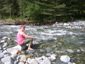
Caroline paddling in the River Liza

Caroline paddling in the River Liza

The last part of the journey followed the wide but shallow River Liza, which were fast running ice cold waters.  We walked on the south side of the river on a fairly wide foresty path for several miles until we came to a bridge.  After we crossed the Liza we went down to put our hot and complaining feet into the icy water.  Felt really good!  Then we tackled the last 3-4 miles on the North bank down to Black Sail.  Every time we crossed a hill crest we hoped to see Black Sail in the distance, and finally, just as it started raining, there she was! Black Sail is a Youth Hostel, the most remote in Britain, and only sleeps 10 people.  We sat in the cozy living area and bought a bottle of wine and waited for our roommates.  The view from Black Sail is amazing.

view of Green Gables and Great Gable from Black Sail Youth Hostel

view of Green Gables and Great Gable from Black Sail Youth Hostel

At Ennerdale Bridge

Finally have internet connection, as warned its been a bit of a struggle for me. I’ve had erratic reception with tmobile and am not able to send emails at the moment from my phone.  If I can fix this, I will be able send more snaps enroute.  Carla’s in better shape with her phone as she has roaming reception with her phone and can pick up the strongest signal, no matter who the carrier.

We had a very smooth travel, all things considered.  Every plane, train and automobile left and arrived on time.  No delays, no missing suitcases… it all fell together perfectly.  Which is just as well as we were EXHAUSTED by the time we got to St Bees.  I think I managed about 3 hours on the plane, Carla a little less.  We both got another hour or so on the train North, but it wasn’t enough.  When we finally got to the St Bees hotel at about 6pm, it was everything we could do to stay awake.  We needed to stay up until 9 or 10pm to adjust to the local time.  So we went down to the beach, explored the village, found a really interesting 12th C church, and went to take a look at the cliffs tops that the next morning would be the start of our long  journey.  We had dinner at the local pub (which was good) and then had to do a massive reordering of “the stuff” that we carrying.  Everything had been sorted for the airport security regulations, and not for our convenience.  So after of lots of messing around with maps and snack foods, lotions and bottles, we passed out and slept like babies until the next morning.

St Bees Church

St Bees Church

St Bees Beach

St Bees Beach

St Bees Head

St Bees Head

After a full English Breakfast (a lot more than my normal bowl of oatmeal) we set out to start the Walk.  We dipped our boots in the Irish Sea and picked out a few pebbles and had our pictures taken near the St. Bees sign (all three traditions for Walkers).   We will carry the pebbles with us each day, and then throw them into the North Sea at the end of the journey.

Caroline and I were thankful for our training as the Walk started uphill to reach the cliffs of the coastline at St. Bees. 

view from Walk looking back at St. Bees

view from Walk looking back at St. Bees

We continued along the path to discover an abandoned Coast Guard station and the St. Bees lighthouse – and the hangout of some cools birds like puffins and guillemots.  We joked that although it’s called the Coast to Coast Walk, we were only doing coast walking.  Finally we began our journey eastward and walked through the villages of Sandwith, Moor Row and Cleator.   We had a bit of a detour on the way to Moor Row as we apparently took a wrong turn, but thank God for some previous Walkers who had posted a sign stating, ‘If you’ve reached this gate you have left the C2C path’ and then gave a quick fix to get us back on the trail.  We stopped for tea in Moor Row, and then continued to Cleator to begin the path up Dent Fell (new vocab for Carla: Fell = hill).  UP and up and up and up we climbed, thankful for our hiking poles, to the summit.  We were pleasantly surprised to turn around and the see all the villages we had walked through as well as the Irish Sea where we had started the day.

view from Summit of Dent Fell

view from Summit of Dent Fell

We continued over Dent Fell on to the VERY STEEP descent of Raven Crag.   We definitely needed the hiking poles, we definitely needed to walk sideways, and we definitely needed little breaks.  It was quite surprising that 3/4 in to the day’s walk we were doing something so challenging, but well worth it when we finally reached the valley and Nannycatch Beck (vocab for Carla: Beck = stream).   (I joked that it might have been easier with a snow sled or skis or even a hanglider – none of which we packed in our packs – hahaha).  We continued into Ennerdale Bridge – I should say we stumbled into Ennerdale Bridge – and checked into the Shepherd’s Arms Hotel.    Had an average dinner at the pub, and managed to stay awake until 11:30pm. 

view from our room at The Shepherd's Arms Hotel

view from our room at The Shepherd's Arms Hotel

The journey to Ennerdale Bridge was 14 miles – a long day.  Today our path takes us to Black Sail Youth Hostel – a short day at 8 miles.  There will be no power, no reception and definitely no internet access – so you won’t get another report until we are at Grasmere or at worst, Patterdale.  If Caroline can troubleshoot her phone, we may be able to post more little report/tweets/posts along the way.